Mapping the Northwest’s Underwater History
We believe strongly in opening of the underwater history to the greater public and explorers. Multiple projects are underway with the sole purpose accelerating research & historical documentation through professional survey data access.
Side scan mosaic of Lake Union - Seattle WA
Lake Union Mapping Project
Lake Union was mapped as part of a project for the Center For Wooden Boats. This allowed a comprehensive understanding of what lies on the bottom of Lake Washington.
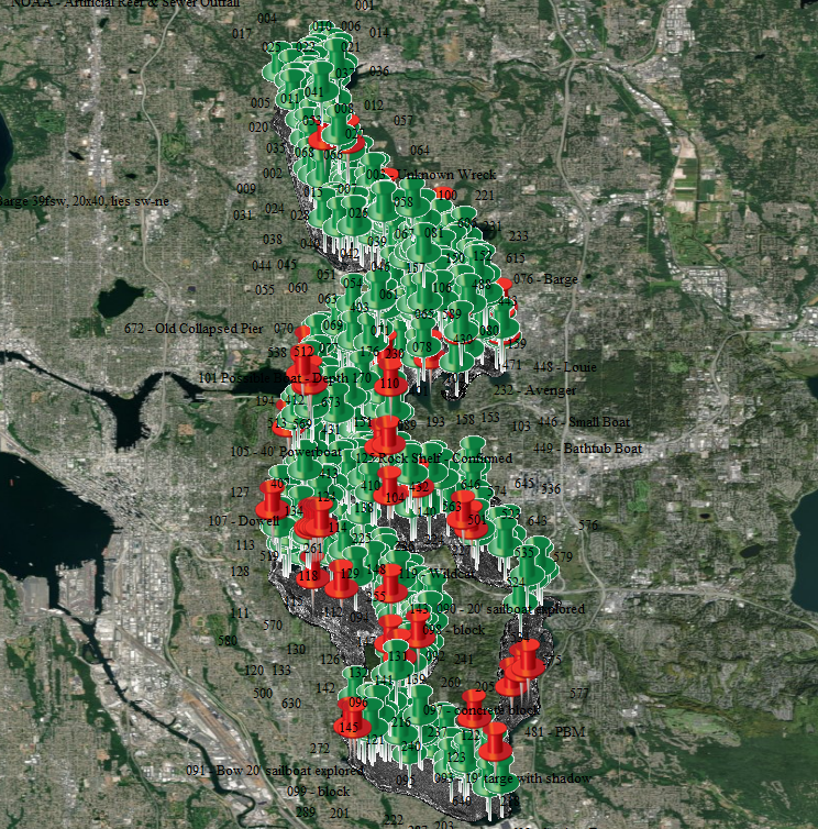
Side scan mosaic and targets in Lake Washington - Seattle WA
Lake Washington Mapping Project
Thousands of hours have been spent mapping and exploring Lake Washington. This ongoing effort and massive undertaking is being conducted in an effort to better understand NW history and heritage.
Bathymetry of Elliott Bay - Limited - Seattle WA
Elliott Bay Mapping Project
While Elliott Bay is a busy shipping port it has not been widely explored. Available Bathymetry for the area is coarse enough that most historical wrecks are not visible. Project waiting to start.


